
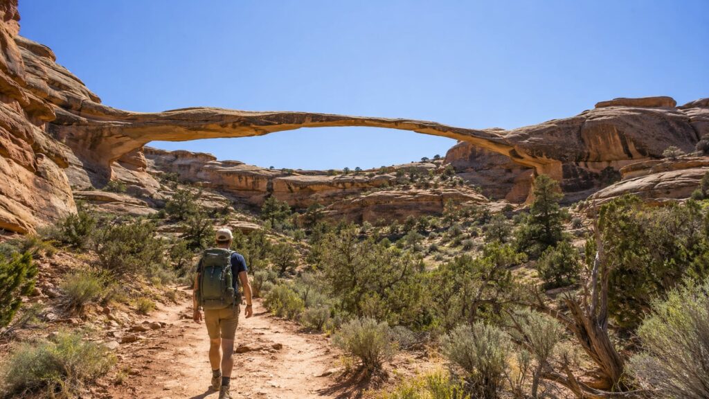
Natural Bridges National Monument in Utah is the strongest choice for top hiking trails featuring beautiful natural bridges. Hike the full loop if you want Sipapu, Kachina, and Owachomo with canyon travel and mesa views. If heat, time, or tired legs make that a poor trade, take the Sipapu-Kachina loop instead. It gives you the monument’s best variety without turning the day into a small expedition.
Last updated: 2026-08-13
The monument sits on Cedar Mesa, where the trails drop from open sandstone country into rough canyon bottoms. That change is the point. You get more than a bridge viewpoint, but you also get steep climbs, slickrock, loose footing, and desert sun that does not care about your itinerary.
Which natural-bridge hike is the best overall choice?
Natural Bridges National Monument leads the list because its trails connect major bridges through real canyon country. You aren’t walking from a parking lot to a rock and back. You’re descending, crossing uneven ground, looking up at sandstone walls, then climbing back toward the mesa.
The right route depends on what you want from the day:
| Your goal | Best choice | Why it fits |
|---|---|---|
| See the whole monument on foot | Full loop | Connects Sipapu, Kachina, and Owachomo with canyon and mesa scenery |
| See strong scenery with less fatigue | Sipapu-Kachina loop | Reaches major bridges without the full return |
| Get the most impressive individual bridge | Sipapu Bridge Trail | The bridge is striking, but the descent and climb back are steep |
| Take a moderate outing | Kachina Bridge Trail | Broad canyon views with less commitment than Sipapu |
| Make a quick scenic stop | Owachomo Bridge Trail | Fast access and a clear payoff |
The full loop is the top overall pick for fit hikers who want a demanding route. It’s also the easiest choice to regret if you start late, carry too little water, or treat the mesa as flat and harmless.
For more Utah route ideas, see this guide to the best hikes in Utah.
What does the full loop include?
The full loop links Sipapu Bridge, Kachina Bridge, and Owachomo Bridge. It moves between mesa-top trail, steep canyon descents, sandy stretches, slickrock, and rough stone steps. Some sections feel like a normal trail. Others ask you to slow down and pick each foot placement.
Sipapu usually comes first for hikers starting from its trailhead. The route drops sharply into the canyon, using ladders, rails, and carved steps in places. Once below the rim, the trail becomes more enclosed and uneven. You’ll spend less time looking across the desert and more time looking at the walls above you.
The route then travels toward Kachina Bridge through the canyon. Kachina feels heavier and more enclosed than Sipapu, with broad rock surroundings and a stronger sense of being below the mesa. After that, the route continues toward Owachomo before climbing back toward open country.
That final return is where optimistic mileage reports stop being useful. Your legs have already handled steep descents, rock, sand, and heat. The climb out comes when your water is lower and your feet are less interested in careful steps. Treat the full loop as a strenuous commitment that deserves an early start, a proper map, and a bailout plan.
The Natural Bridges National Monument page from the National Park Service is the right place to confirm current maps, closures, and conditions before you leave.
Which shorter loop gives the best return for the effort?
The Sipapu-Kachina loop is the best shorter option. You still get major bridge scenery and a good stretch of canyon without spending as much energy on the longer mesa return.
It is not an easy walk. The Sipapu descent is steep, and the canyon floor brings uneven rock, sand, and slick surfaces. You’ll still have to climb back out, so don’t read “shorter” as “casual.”
The payoff is strong. You get Sipapu’s dramatic scale, Kachina’s broad stone setting, and a route that changes from open rim views to shaded canyon sections. That variety gives the loop more value than a short out-and-back to a single viewpoint.
Choose this route when:
- You want major bridge scenery without the full-day effort.
- You’re hiking in shoulder-season weather but still want a serious outing.
- Your group has mixed fitness levels.
- You need a route with a clear turnaround point.
- You’d rather finish with energy for the drive than collect every bridge.
Start early anyway. Desert heat builds before the trail looks difficult, and the climb back from the canyon will expose every bad decision.
How do the individual bridge trails compare?
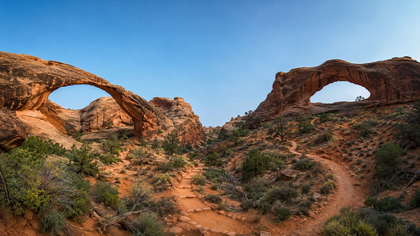
Each individual trail has a clear use. None is a universal winner.
Sipapu Bridge Trail
Sipapu is the most impressive individual hike if you want a major bridge and don’t mind a steep route. The bridge rises above the canyon with enough scale to make the descent worthwhile.
The trail uses steep sections, ladders, rails, and uneven rock. Your knees will notice the way down, while your lungs will remember the way back up. Pack weight matters here, especially if you’re carrying water for a hot day.
Sipapu is the right pick for strong hikers with limited time. It is the wrong pick for anyone who sees a short trail name and assumes an easy walk.
Kachina Bridge Trail
Kachina is the best moderate individual outing for broad canyon views and a more manageable effort. The landscape around the bridge feels substantial, with rock walls and canyon space doing more of the scenic work than distant overlooks.
The trail still includes a descent and a climb. However, it feels less punishing than Sipapu for many hikers. Take this route when you want a real canyon hike without committing to the full loop.
Kachina also works well for hikers who want time to study the rock, pause in shade, and avoid rushing back before the day gets hot.
Owachomo Bridge Trail
Owachomo gives you the quickest payoff. The approach is easier to fit into a crowded day, and the bridge is close enough that limited-time visitors can still see the main feature.
It is also the least satisfying standalone hike if you want changing terrain. You get the bridge and the surrounding desert, but not the same canyon travel found on the longer routes.
Choose Owachomo for a short stop, a family schedule, or a day when your legs are already carrying too much from another hike. Keep your expectations honest, and it does its job well.
What are the canyon and mesa-top sections like?
The mesa-top sections are open, exposed, and easy to underestimate. You may have broad views and a clear sky, but shade is limited. Wind can dry you out without making the heat feel obvious.
The canyon sections change the mood and the work. Walls provide shade in places, but the trail surface becomes rougher. Sand can slow you down, slickrock can turn awkward, and rock steps can force a careful pace.
You’ll also move through different kinds of scenery:
- Open Cedar Mesa views with little protection from sun.
- Steep descents into sandstone canyons.
- Narrower passages near bridge approaches.
- Sandy or rocky canyon-bottom travel.
- Overlooks that show how far you still have to climb.
- Shaded sections that feel welcome but do not last forever.
The route can look calm from the rim and still feel demanding below it. That contrast is why Natural Bridges earns its place among the top hiking trails featuring beautiful natural bridges. The scenery changes because the trail changes elevation, not because someone placed a viewpoint every few minutes.
Are these short hikes or moderate-to-strenuous hikes?
The individual trails vary, but the monument is not a flat walking destination. Even the shorter routes can include steep grades, uneven footing, exposed rock, and a hard climb back to the rim.
Use the trail choice below as a practical guide:
- Full loop: Strenuous and best treated as a full-day objective.
- Sipapu-Kachina loop: Strenuous, though more efficient than the full loop.
- Sipapu: Shorter than the loops, but steep enough to demand strong legs.
- Kachina: Moderate for experienced hikers, with real climbing and rough ground.
- Owachomo: Easiest access, but still a desert trail rather than a paved stroll.
Your pace will depend on heat, pack weight, water carry, footing, and how long you spend at the bridges. Trip reports often list moving time and ignore the part where you stop to cool down, find the route, or let a tired hiker catch up.
If you’re used to smooth park paths, choose Owachomo or Kachina first. If you hike steep trails regularly, the Sipapu-Kachina route is the better test. Save the full loop for a day when you have enough time to turn around before fatigue makes every step sloppy.
What should you bring for desert conditions?
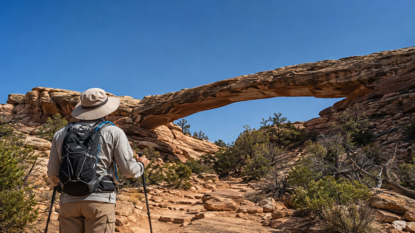
Bring enough water for the route, weather, and group. Natural Bridges is not the place to depend on finding a convenient refill in the canyon.
Pack for temperature swings and exposed terrain:
- Plenty of water, with extra capacity for heat.
- A sun hat, sunglasses, and clothing that covers your shoulders.
- A light layer for cool mornings and windy mesa sections.
- Sturdy shoes with soles that grip rock.
- Snacks you’ll still want after hours of heat.
- A paper or downloaded map.
- A small first-aid kit for hot spots, scrapes, and blisters.
- A headlamp if your timing could slip into evening.
- A layer that dries reasonably well after sweat.
Avoid smooth casual shoes. They slide on slickrock and leave your feet working harder than necessary. Sandals are also a poor bet on steep, rocky sections unless you enjoy collecting grit in places it should not be.
Keep pack rub under control before you start. A shoulder strap that feels fine in the parking area may feel personal after the canyon descent.
How should you check maps and current trail conditions?
Use the official monument map before you choose a route. Mark the trailhead, bridge order, likely climb out, and any place where you could reasonably turn back.
Then check current conditions before driving to the monument. Flash floods, rockfall, snow, ice, trail work, and road closures can change the plan. A GPS track from an old trip may show a route that is now closed, hard to follow, or unsafe after weather.
The National Park Service trail information for Natural Bridges should take priority over an optimistic trip report. If the visitor center is open, ask about closures and recent trail conditions. That short conversation can save a long walk toward a route you cannot finish.
Also check the rules for pets. Pets generally cannot follow the backcountry trails, while service animals have separate access rules. Don’t bring a dog into a steep canyon route and hope the policy is flexible. It isn’t a good plan for the dog, either.
For broader advice on lower-commitment routes, these short hikes for beginners are a better starting point than forcing a strenuous desert loop.
Which route fits your time and fitness?
Choose the route before you arrive, not after the heat has settled in.
- For a full-day objective: Take the full loop if you’re fit, start early, carry enough water, and can handle steep canyon travel.
- For strong scenery with less commitment: Take the Sipapu-Kachina loop. It gives you major bridges, canyon variety, and a more sensible turnaround.
- For a moderate single-bridge hike: Choose Kachina when you want canyon views without the sharper effort of Sipapu.
- For the most striking individual bridge: Choose Sipapu, but respect the climb back to the rim.
- For a quick scenic stop: Choose Owachomo and keep the rest of the day simple.
These are the top hiking trails featuring beautiful natural bridges because they give you choices that match real trail conditions. Your best route is the one you can finish with steady footing, water left in your pack, and enough energy to walk back to the car.
FAQ
Can beginners hike at Natural Bridges National Monument?
Beginners can start with Owachomo if they’re comfortable on uneven desert ground. Kachina may suit beginners with good fitness and prior hiking experience, but Sipapu and the longer loops demand more confidence on steep terrain.
Are the natural bridges visible from the road?
Some bridges have nearby viewpoints or short approaches from the road. However, the strongest canyon experience comes from descending below the rim, where the surrounding walls make the bridge feel much larger.
Is Natural Bridges a good place for a late afternoon hike?
It can work for a short route in mild weather, but late starts are risky on longer trails. Heat, fading light, and the climb back to the mesa leave less room for a wrong turn or slow group member.
What should you do if the trail feels too hard?
Turn around before the climb becomes unsafe. A bridge is not worth a heat problem, a twisted ankle, or a dark return through unfamiliar canyon ground.
Are natural bridges and natural arches the same thing?
No. A natural bridge is shaped by flowing water, while a natural arch forms through other erosion processes. The names get mixed together in travel copy, but the difference matters when you’re reading park information.
