
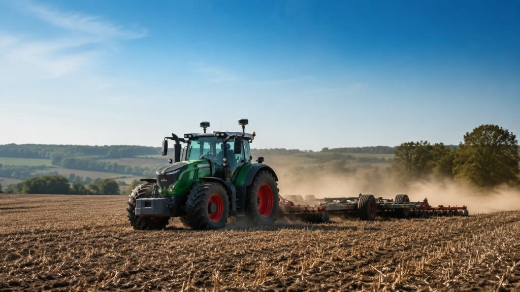
GPS-guided land leveling is a precision-farming tool for grading real acreage, not a gadget for the backyard. If you run flood or furrow irrigation on large flat fields and re-grade the same low spots every season, gps guiding leveling earns its keep by cutting passes, saving fuel, and stopping you from grading twice. For small plots, garden beds, or a driveway, it costs far more than the job is worth. And if you landed here hoping for trail navigation, you want a handheld unit, not a tractor rig.
What is gps guiding leveling, and who actually needs it?
The system uses satellite positioning to steer a tractor and control a blade or scraper until a field matches a planned surface. Think of a laser level scaled up to whole fields, run by a receiver on the cab and a base station on the ground.
Who benefits: growers with flood or furrow irrigation, big flat fields, and drainage that never quite works. Rice, cotton, and row crops on graded ground use water more evenly and waste less.
Who's wasting money: small acreage, hobby farms, and anyone leveling by eye once a decade. A rented laser grader or a contractor does that cheaper. Buy the system when you level often enough that the fuel and time savings outrun the price.
GPS leveling pays back in water, fuel, and yield
A field graded flat drains predictably and floods evenly. That's the whole point. Water sits where you want it, not in three low corners that drown seedlings while the high end goes dry.
The gains stack up in plain terms:
- Water: even flooding means less waste and fewer dry patches.
- Yield: consistent moisture lifts the weak zones.
- Fuel and time: fewer passes to hit grade, less re-work next season.
- Drainage: planned slope moves standing water off before it rots roots.
The Hetao irrigation district in China leans on this scale of leveling heavily, because flood irrigation across huge flat blocks lives or dies on how flat the ground really is. Uneven ground wastes water, and there water is the constraint.
None of this shows up on a demo lot. It shows up two seasons in, when the field you graded once still drains right and you haven't touched the low spots again.
GNSS is the umbrella; GPS is one system under it
GPS is the American satellite constellation. GNSS, short for Global Navigation Satellite System, is the broader term. It covers GPS plus Russia's GLONASS, Europe's Galileo, and China's BeiDou.
Why it matters in a field: more constellations mean more satellites in view. That gives you a steadier fix near tree lines, buildings, or on a bad-weather day. A receiver that listens to one constellation drops out more often. One that pulls from several holds its lock.
When a spec sheet says "GPS" but the receiver is really multi-constellation GNSS, that's marketing shorthand, not a downgrade. Just confirm which constellations it tracks before you trust the label. You can read how the official U.S. service defines all this on the government's GPS information site.
How RTK gets you to centimeter accuracy
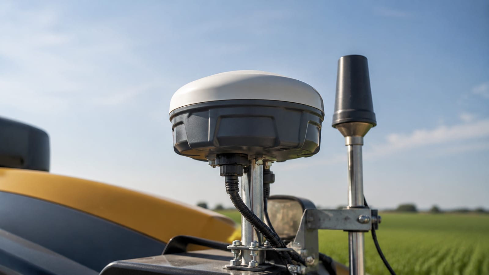
Plain GPS on your phone is good to a few meters. That's useless for grading. Real-Time Kinematic positioning, or RTK, fixes this. A base station at a known point measures the satellite error and sends a correction to the tractor's receiver constantly.
The tractor takes the raw fix, applies the correction, and lands within a couple centimeters instead of a couple meters. That's the difference between a flat field and a lumpy one.
For grading, centimeter accuracy isn't a luxury tier. It's the floor. Anything looser and you're chasing high spots by hand. If a system can't hold an RTK fix, it can't level. The AllyNav W20 GPS Land Leveling System, for example, is rated around 2.5 centimeters, which is the ballpark the blade needs to do useful work.
Single-antenna versus dual-RTK: pay for the second antenna
A dual-RTK setup is worth the extra cost if your ground has any real slope or side-hill, and most fields do. Here's the split.
| Single antenna | Dual RTK | |
|---|---|---|
| Position | Yes | Yes |
| Roll/tilt on slopes | Guesses or ignores | Measures directly |
| Operator fatigue | Higher on turns | Lower |
| Cost | Less | More |
| Best for | Flat, simple fields | Slopes, side-hill, precise grade |
A single antenna knows where the tractor is but not how it's leaning. On a side slope, that tilt throws the blade height off, and you're re-grading. A second antenna reads the machine's roll and corrects it in real time.
Buy dual when you know your fields tilt, not because the brochure shows two antennas. Still, most operations that need leveling at all have enough slope that the second antenna stops the re-grade problem cold. That's where the money earns out.
What a GPS leveling system actually costs
Expect several thousand dollars at the low end for a basic single-receiver kit, and well into five figures for a full dual-RTK system with a good base station and blade control. Autosteer, the base, and the display each add up.
Where cutting corners is fine:
- Buy the receiver used or refurbished if it's a supported model with current firmware.
- Skip the fanciest display if a basic one runs your software.
- Start with a mobile base instead of building fixed infrastructure.
Where cheaping out costs you:
- The RTK correction source. A weak or unsupported service means dropped fixes and re-grading. This is the whole game.
- Blade or valve control hardware. Sloppy actuators undo good positioning.
- Dealer support. A cheap system nobody local can service is a false economy the first time it fails at planting.
The TOPO-Steer Land Leveling Auto Steering System is one example of a package built for grading rather than a generic guidance kit bolted onto the job. A system made for leveling usually beats stitching parts together.
Mobile base or fixed base: match it to how you farm
A mobile base station sets up fresh at each field and packs away when you're done. A fixed base lives on a permanent mount and covers everything in range from one known point. Pick by geography and how spread out your ground is.
Go mobile if your fields are scattered, rented, or change year to year. You carry the base, set it, level, and move on. The tradeoff is a few minutes of setup each time and re-establishing the reference point.
Go fixed if your acreage is clustered around one operation and you'll use RTK for planting, spraying, and leveling all season. One surveyed point serves everything, and you skip daily setup. The cost is the install and the fact that it doesn't travel.
For most growers starting out, mobile is the honest first move. It's flexible, cheaper to begin with, and you learn what you actually need before pouring a base into concrete.
Can GPS guidance handle drainage and trenching precision?
Yes, but drainage is a tighter job than field leveling, and the tolerance shows it. Field grading forgives a centimeter here or there across a wide surface. A drain or ditch needs a continuous, correct slope so water keeps moving and never pools.
So RTK is non-negotiable for drainage. The centimeter accuracy does real work over long runs. One high spot in a trench and water backs up right there.
For tile drainage especially, the system controls depth as well as position so the pipe holds constant fall. If you're grading fields today and see tile drainage coming later, buy a system that supports depth control now. Retrofitting it later costs more than choosing right the first time.
Does GPS leveling gear work with autonomous tractors?
Increasingly, yes. The same RTK positioning that steers a driver-assisted tractor is what a driverless one needs to run. Autosteer is the bridge. A system that already does hands-off guidance is most of the way to autonomous operation.
If you expect to move toward driverless equipment, check that your positioning system and its correction source use open, supported standards rather than one brand's locked ecosystem. That's the difference between upgrading and buying everything twice.
Don't pay a premium today for autonomy you won't use for years. But don't buy a dead-end proprietary box either. A well-supported RTK system with a documented data format future-proofs you without the fantasy price tag.
What to check before you buy
Run this list before spending anything:
- Constellation support: does it track multiple GNSS systems, or just GPS?
- Correction source: what RTK service or base does it use, and is it reliable where you farm?
- Accuracy spec: is it rated in centimeters, and under what conditions?
- Slope handling: single antenna or dual RTK, and does your ground need the second one?
- Blade/valve control: is the hardware precise enough to match the positioning?
- Base station type: mobile or fixed, and which fits your field layout?
- Local support: can someone nearby service and update it?
- Total cost of ownership: subscription fees, correction service, firmware, and repairs, not just the sticker.
The pattern that burns people is buying on receiver accuracy alone while ignoring the correction source and support. Great positioning with a flaky correction feed still leaves you re-grading. Buy the whole chain, or don't bother.
If your real interest is finding your way on foot rather than shaping fields, our beginner's guide to GPS navigation on trails and the rundown on GPS watches versus handheld units are the right pages for you.
FAQ
Will GPS leveling work in areas with weak cell signal?
RTK correction doesn't have to ride on cell service. A local base station broadcasts corrections over radio to the tractor, so remote fields with no bars can still get a centimeter fix. Cell-based networks are convenient, but they aren't your only option. Check what your system supports before assuming you need coverage.
How long does a base station take to set up each morning?
A mobile base runs a few minutes once you know the routine: mount it, power it, let it settle on its reference point, and confirm the tractor has a fixed solution. A fixed base skips this. Budget for that daily few minutes if you go mobile and farm scattered ground.
Does weather affect grading accuracy?
Heavy tree cover, buildings, and severe space weather can weaken satellite reception, which is why multi-constellation GNSS matters. Rain itself rarely breaks the fix. The bigger risk is losing your RTK correction link, so a stable base and a solid radio or data connection matter more than the forecast.
Can I move one system between multiple tractors?
Often yes, if the mounting and hydraulic or steering interface match. The receiver and display are the pricey parts, and sharing them across machines spreads the cost. Confirm the autosteer and blade-control hardware fit each tractor before assuming one kit covers your whole fleet.
