
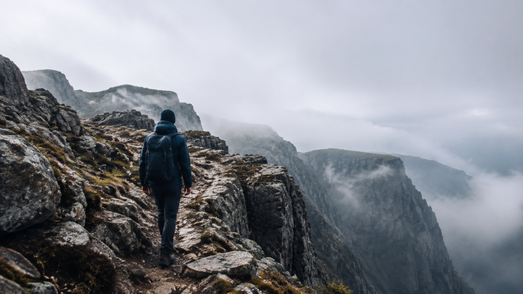
The Faroe Islands reward hikers who want big coastal drama in short bursts, not long mileage. Head to Kallur Lighthouse on Kalsoy for a ridge walk to a white lighthouse above the sea, Lake Sørvágsvatn on Vágar for the floating-lake illusion, and Gásadalur to Múlafossur for a waterfall that drops straight into the Atlantic. The scenery is unreal, but ferries and tunnels dictate your day, many trails cross private grazing land with a small access fee, and fog can erase a famous view in minutes. Come for the walking, plan around the logistics, and treat the weather as the boss it is.
Where do the Faroe Islands fit for a hiking trip?
They fit hikers who want dramatic coast without long, punishing miles. Most signature walks are short. The difficulty is footing, exposure, and wind, not distance.
Think of it as Ireland's cliffs and Iceland's rawness in a smaller, wetter package. If you like ocean hiking, our roundup of coastal hikes in Ireland covers a gentler cousin of the same terrain.
The trade-off is access. Many routes sit on grazing land, and landowners charge a small fee at the trailhead. That is not a scam. It funds upkeep on ground that sheep and boots both chew up.
The trails worth your ferry time
Below are the walks that earn the ferry rides and the parking hassle. Each one suits a different kind of day.
| Trail | Where | Roughly | Best for |
|---|---|---|---|
| Kallur Lighthouse | Kalsoy | 974 ft of climbing | Big drama, short effort |
| Lake Sørvágsvatn | Vágar | 3km each way | The famous cliff illusion |
| Gásadalur to Múlafossur | Vágar | 0.5-1 hr | Waterfall over the sea |
| Kollafjørður to Leynar | Streymoy | 5 kilometres | Quiet old walking route |
Kallur Lighthouse on Kalsoy is the one people fly in for. You take a ferry, drive through single-lane tunnels, then walk a green ridge to a white lighthouse perched above the sea. It packs about 974 feet of climbing into a short outing, but the final approach is narrow with real drops. In fog or wind, that last stretch is where people get in trouble.
Lake Sørvágsvatn on Vágar delivers the photo where a lake appears to float high above the ocean. The walk in runs about 3km one way on mostly easy ground. Because it crosses private land, expect a fee at the start. The illusion needs the right angle and clear air, so give yourself margin.
Gásadalur to Múlafossur is the short one, around a half hour to an hour. You are here for the waterfall that spills straight off a cliff into the Atlantic. It sits close to the road, however, which means crowds and camera tripods. Go early or late.
Kollafjørður to Leynar on Streymoy is the quiet pick, about 5 kilometres of old cross-island walking route. Fewer people, more solitude, less spectacle. If the famous spots feel like a queue, this is your reset.
What makes these hikes harder than the numbers suggest?
The distances lie. A "short" Faroese hike can still wreck you because of what is underfoot and overhead.
Wind is the real difficulty rating. Gusts near a cliff edge do not care about your fitness. On exposed ridges like Kalsoy, a strong day is a turn-back day, not a tough-it-out day.
Footing comes second. Grass over rock gets slick when wet, and it is wet often. Bog sucks at your shoes, and sheep paths braid and vanish. As a result, your pace drops well below what a flat trail would give you.
Fog is the quiet one. It rolls in fast and swallows the trail and the view together. If you cannot see the next marker, stop and wait or turn around. The cliff does not move, but you might.
What to pack for Faroese trails
Pack for cold rain sideways, even in July. Sweat management matters less here than staying dry and windproof.
- A real rain shell, not a "water-resistant" jacket that wets out in the first hour.
- Waterproof boots with grip, because wet grass on rock is the local sport.
- Warm mid-layer and a hat. Wind chill does most of the damage.
- Offline maps and a charged phone. Signal drops between islands and in fog.
- Cash or card for trailhead access fees.
Trekking poles help more than usual here. Bog, mud, and steep grass reward anything that adds stability. If you already carry them for downhills, keep them in.
For a colder, bigger-mountain version of this kit logic, our guide to hiking Iceland's national parks covers layering for the same North Atlantic mood.
How do ferries and tunnels shape your day?
They shape it more than the trails do. Getting to Kalsoy for the Kallur walk means a ferry with limited sailings and a queue in peak season. Miss it, and your plan slides by hours.
Sub-sea and single-lane tunnels connect much of the country. Some charge tolls. Single-lane tunnels have passing bays and right-of-way rules, so read them before you drive one in the dark.
Build slack into every day. One ferry, one weather window, and one wrong turn can eat an afternoon. Because sailings are tight, two big hikes in one day is optimistic unless they share an island.
When to go, and when to skip a hike
June through August gives the longest daylight and the best odds of a clear view. It also brings the most people and the highest ferry demand. Shoulder-season trips in May or September trade crowds for less reliable weather.
Winter hiking is for experienced people only. Short days, ice, and brutal wind turn easy summer walks into serious outings.
Skip a specific hike, not the trip, when the forecast turns. A socked-in Kallur ridge gives you nothing but risk. Instead, swap to a lower, sheltered walk and save the cliff for a clearer window.
Who should think twice about this trip
Hikers chasing long mileage will feel short-changed. This is not a place for big daily distances. The reward is intensity and scenery, not a fat step count.
People uneasy with heights should be honest with themselves. Several marquee walks put you near real cliff edges with wind pushing. There is no shame in stopping at the last safe spot and enjoying the view from there.
If you want mountains without the ferry math, compare notes with our list of underrated mountain trails across Europe instead.
For background on the islands themselves, the Faroe Islands entry covers the geography and climate worth understanding before you plan.
FAQ
Do I need a guide to hike in the Faroe Islands?
For most marked walks, no. You can do Sørvágsvatn, Múlafossur, and Kallur on your own in fair weather. That said, a guide earns its cost on remote or exposed routes, in poor visibility, or if you are new to cliff-edge terrain.
Are the trailhead fees legitimate?
Yes. Much of the hiking land is privately owned grazing ground, and small fees fund maintenance and access. Pay them at the marked booth or online where required, and treat them as part of the trip cost.
How fit do I need to be?
Moderate fitness covers most named hikes, since they are short. The bigger demands are balance and comfort with wind and exposure, not endurance. So if you can handle a few hours on wet, slanting terrain, you are set.
Can I wild camp between hikes?
Generally no, not freely. Camping is restricted and much of the land is private, so use designated sites and ask permission where needed. Plan lodging in villages and treat the trails as day walks.
What happens if fog rolls in mid-hike?
Stop moving toward any drop-off and reassess. If you cannot see the next marker or the ground ahead, wait for a break or retrace your steps. Turning back early is the normal, sensible call here, not a failure.
