
Ever wondered why seasoned trekkers still trust a simple needle when electronics fail?
I’ve seen GPS units die, screens crack, and batteries give out on long routes. That’s when a reliable navigational tool becomes the day’s hero.
This short guide shows a clear, step-by-step way to pair a topographic map with a baseplate compass and then practice those skills outdoors until they stick.
You’ll get plain explanations, real tips used by search-and-rescue teams, and gear notes like Suunto and Silva models that make sense for most budgets.
We’ll also link smart app use as a backup, and point you to trusted options like the best hiking compasses when you want to pick gear.
Key Takeaways
- Traditional tools teach you to read terrain and build a mental map you can trust.
- Practice short techniques immediately on easy trails to make them second nature.
- A baseplate compass and a topo sheet are foundational navigational tools.
- Use GPS as a support, not a sole plan; batteries fail in the wild.
- Simple, repeatable workflows help you plan, navigate, and adjust on the trail.
Start here: what map and compass can do for you on today’s trails
A simple set of skills will keep you on course even when your phone quits.
Learn core techniques that pair a paper map with a baseplate compass, then practice them on familiar ground. That combo builds a reliable mental picture of terrain and gives you control when tech fails.
Why these skills still matter
Phones and gps units are handy, but batteries die and signals drop. Solid navigation skills let you keep moving safely and make calm decisions when equipment stops working.
The navigation toolkit
- Primary: a printed map and a durable compass for clear, repeatable bearings.
- Backup: apps like Gaia GPS or other gps units to verify position and save time.
- Techniques: simple dead reckoning and environmental cues — trees, ridgelines, streams — to confirm where you are.
Simple language promise
I keep instructions short and practical so you can try them the same day. Plan a route at home, set a few checkpoints, and test the steps on an easy trail.
When you hike with someone else, share checkpoints and check often. Two people tracking progress reduce mistakes and save time if you must reroute.
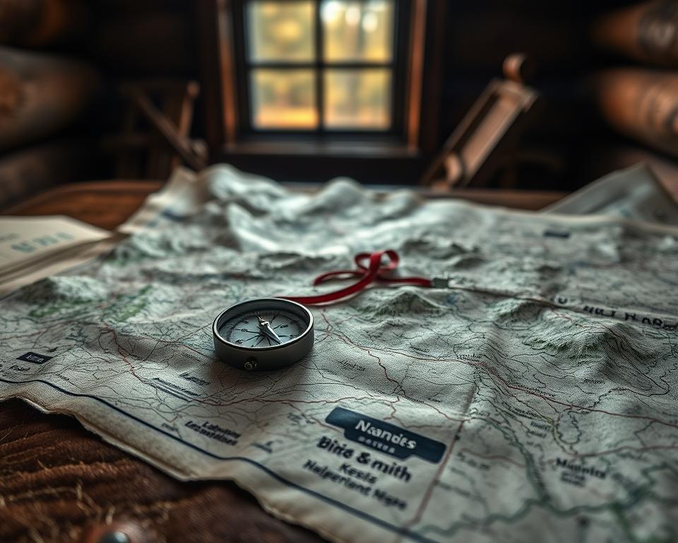
Essential gear for compass hiking: what to carry and why
A small, reliable kit beats bulky gadgets when conditions turn ugly. I pack a few proven items that I actually use on every trip.
Choosing a base plate, needle model with clear durable features
Pick a high quality base plate compass with an easy-to-read bezel and a steady red needle. Look for scratch-resistant plastic, crisp index lines, and a smooth azimuth ring that turns with gloves on.
Trusted names like Suunto (A-30) and Silva make solid, affordable compasses that settle fast and hold a bearing.
Topographic maps and scale that work well
A 1:24,000–1:25,000 topographic map gives enough detail to read contour lines, water features, and trails without overwhelming you. Carry one printed sheet even if you use gps units as a backup.
- Transparent base plate lets the map and compass work together when aligning edges.
- Pack a pencil and a simple map case or zip bag to protect paper from wet weather.
- Check your compass regularly; if the bezel sticks, replace it before your next outing.
| Item | Key features | Best use |
|---|---|---|
| Suunto A-30 | Clear bezel, stable red needle, budget-friendly | Everyday backcountry routes |
| Silva base models | Durable base, smooth azimuth ring, crisp lines | Long day hikes and multi-day trips |
| Topographic maps (1:24k–1:25k) | Detailed contours, trails, water features | Route planning and on-trail decision making |
Compass anatomy made simple
Knowing a compass’s parts makes bearings simple and saves time on the trail.
What to watch on the tool
Start with the base plate — a clear plastic ruler that sits on your map so you can line up routes and read scales. The bezel, or azimuth ring, is the rotating ring with degree markings you turn to set a bearing.
The orienting arrow and grid lines sit inside the bezel; you align them with map north or the red needle. The direction-of-travel arrow on the base plate points the way you will walk once the housing is set.
Regional balance and how it works
The red end of the floating needle always points to magnetic north. To use it, rotate the housing until the needle sits inside the orienting arrow — we call that “boxing the needle.” That’s how the compass works in practice.
Quick practical tips
- Many compasses are balanced for the northern or southern hemisphere; global models work worldwide but cost more.
- Remember which end is the front: the end without the lanyard is the top you point to your destination.
- Check degree markings and practice turning the bezel with gloves; small features can cut errors in bad weather.
| Type | Best use | Notes |
|---|---|---|
| Northern | Most of the U.S. | Balanced for northern inclination |
| Southern | High southern latitudes | Designed to balance needle tilt |
| Global | World travel | Works in both hemispheres; pricier |
Declination: aligning your compass with true north
That red needle points to magnetic north — and the gap to true north matters every time you take a bearing. I keep this step simple: find the current offset, set it, then trust your readings on the map.
What declination means and why it moves
Declination is the angle in degrees between magnetic north and true north. It varies by area and shifts over time as the Earth’s field changes.
Old map legends can be out of date. Don’t rely on printed values when planning a trip.
How to get current values and set your tool
Use NOAA’s declination calculator and enter a ZIP code or coordinates to get the latest value expressed east (positive) or west (negative).
- If your model has a declination screw, set that once and your bearings match the map without extra math.
- If it cannot be adjusted, add or subtract the value each time you set a bearing, noting east or west.
- Make a quick pre-hike checklist: look up declination, set the device, mark it on the map margin, and verify with one bearing.
| Item | How to set | Quick tip |
|---|---|---|
| Adjustable tool | Turn declination screw to NOAA value | Lock bezel and box the needle |
| Fixed tool | Manually add/subtract degrees | Write value on map margin |
| New area | Check updated info before travel | Re-check when you change regions |
Reading topographic maps with confidence
A quick look at contour lines will tell you whether the climb ahead is a grind or a stroll. Start on familiar ground and match what you see to the paper before you move.
Match terrain to the sheet: contours, watercourses, trails, and landmarks
Read contour lines like a story. Tight lines mean steep ground. Wide spacing means gentle slopes. V-shaped contours point upstream in valleys.
Check watercourses, ridges, and trail junctions. Note cliffs and saddles so you won’t be surprised by a steep drop or a false summit.
Set up your map for quick decisions on the trail
- Highlight the route and circle decision points to spot them fast in wind or low light.
- Mark time-based ticks on the edge (e.g., 45 minutes to a ridge) to pace your progress.
- Fold the paper so the visible section shows only the area ahead; refold as you pass checkpoints.
- Use your compass to orient the sheet so north on the paper matches the ground; this makes features line up.
| Feature | What to read | Quick action |
|---|---|---|
| Contours | Spacing indicates steepness | Adjust pace and route |
| Watercourses | V-shapes and streams mark valleys | Use as handrails |
| Junctions | Trail forks and crossings | Circle and set checkpoints |
Map compass navigation for hikers: take and follow a bearing
Taking a clear bearing is the quickest way to move from doubt to steady ground. I use short, repeatable steps so you can set a heading, pick a visible target, and keep moving without overthinking each turn.

By map: draw, set, box, walk
Place the base plate edge along a straight line from your current spot to the next checkpoint. Point the travel arrow toward your target.
- Rotate the azimuth ring until orienting lines align with north on the topographic map; this sets the degree.
- Lift the device and turn your body until the red needle sits inside the orienting arrow—now walk the line.
- Pick an intermediate point (tree, rock) on that line and move to it, then repeat.
By sight in the field: point, set, align, go
Point the travel arrow at a visible landmark. Rotate the bezel until the orienting arrow boxes the red needle. Walk while keeping the needle aligned.
Back bearing: return the way you came
To go back, rotate the azimuth ring 180 degrees and box the needle again. That back bearing points to your original position.
| Action | Quick tip |
|---|---|
| Leapfrog with a partner | One sets the bearing, the other walks to them |
| Re-check after obstacles | Small detours add up—reset degrees and pick a new visible point |
| Use handrails | Ridges or streams reduce drift between bearings |
Smartphone apps and GPS units as a backup, not a crutch
Treat your phone and gps units as an extra set of eyes, not the only ones you trust. Use apps to plan and verify, but keep paper skills first.
Create routes, record tracks, and verify position
Before you leave home, create a route with a high quality app like Gaia GPS. Estimate mileage and elevation, then share the link with two trusted contacts.
Record a track during the day so you log progress and review pace later. Use waypoints at junctions or river crossings and confirm each one with the terrain before you move on.
Download maps, save battery, and keep paper handy
Download offline maps for the entire route and alternate exits. Conserve battery: switch to airplane mode, dim the screen, and keep the phone warm in a jacket pocket.
- Use the phone to verify a decision made with your paper map and compass, not to replace it.
- Set timed check-ins to compare position and time against your plan.
- Keep critical information on paper—emergency contacts, route notes, and declination—so one device failure won’t cost you.
| Action | Quick benefit | When to use |
|---|---|---|
| Plan route in app | Accurate mileage & elevation | At home, before the day |
| Download offline maps | Works without service | Before you leave cell range |
| Record track | Post-hike review of time & pace | During the hike |
Dead reckoning and staying found
Estimate your arrival by time, not guesswork, and you’ll cut navigation errors fast.
Dead reckoning uses the simple formula Distance = Rate × Time. Flip it to Time = Distance ÷ Rate to predict checkpoints. Example: at 3 mph, 6 miles takes about 2 hours.
Apply the math on the trail
Start each segment by noting the time, the distance to the next checkpoint, and your expected pace given terrain and pack weight.
- If a segment is 2 miles and your pace is 2.5 mph, expect roughly 48 minutes.
- If you miss that window, stop and check the map and compass before you drift farther.
- Adjust estimates for steep climbs, loose rock, or thick brush — these slow your pace.
Learn your pace and use it wisely
Record a few day trips with an app to learn typical paces on flat, rolling, and steep ground. Over a few days you’ll dial in reliable averages.
In a confusing situation, dead reckoning anchors you to time and distance. Combine it with strong handrails and frequent checks to stay found and keep your group moving safely.
Practice plans, safety habits, and real-world use
Small, repeatable drills on familiar ground turn theory into reliable field skills. Short sessions build muscle memory and reduce mistakes when a real situation appears.

Field drills and safe progression
Start with 20–30 minute blocks on a nearby trail. Focus on one technique: taking a bearing, doing a back bearing, or dead reckoning. Repeat the same loop until it feels natural.
Bring two compasses when you can and compare readings. Hike with someone else and trade roles: one leads with the map, the other verifies the bearing. Swap regularly to build confidence in both.
- Off-trail reps only after you’re solid on bearings and back bearings; set a strict turnaround time.
- Share the plan on group trips so every hiker knows checkpoints and bailout routes.
- Use a simple “oh-no” protocol: stop, breathe, check the map and compass, confirm last known point, then pick the next way.
| Drill | Duration | Goal |
|---|---|---|
| Bearing to landmark | 20–30 min | Set and follow a heading to a visible feature |
| Back bearing | 15–20 min | Return accurately to start point |
| Dead reckoning | 30 min | Estimate distance using pace and time |
Pack a small field kit: pencil, waterproof notebook, whistle, headlamp, and spare batteries. Track progress against time goals and reflect after each trip. This tight feedback loop speeds learning and makes compass hiking a reliable way to travel.
Conclusion
Good navigation habits begin with short, honest practice sessions that fit into real days. Build a simple system: map plus a reliable compass, verify with tech, and mix in dead reckoning and waypoint checks like search-and-rescue teams do.
Keep the basics tight: bearings, back bearings, and honest time checks. Record a short track after each outing to see where pace drifted and what to refine. Treat each loop as mini training that beats one long cram session.
Now pick a nearby loop, pack a baseplate map and compass, and practice over the next few days. Bring a friend and teach one thing you learned — teaching cements the skill and makes every mountain day safer and more fun.
